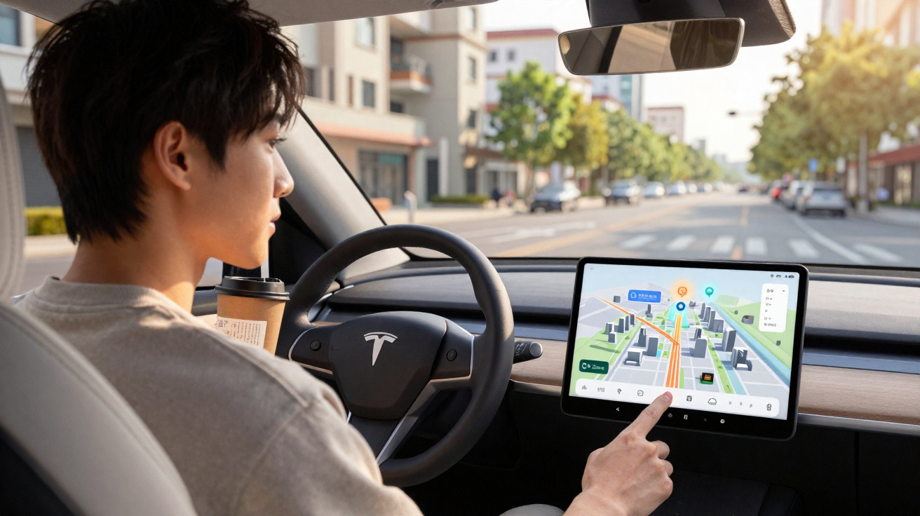
Until now, anyone who thought Google Maps could do little more than calculate routes and show traffic jams is in for a surprise over the coming months. The company is rolling out its biggest change in more than ten years: navigation is moving into the third dimension, the voice assistant is becoming far more intelligent, and an AI powered by Gemini will answer complex questions about places, routes and activities. The features will launch in the US first, with the rest of the world following gradually.
What is fundamentally changing in Google Maps
Google is grouping the updates into two major components: “Immersive Navigation” and “Ask Maps”. Both rely on the Gemini models that the company has been integrating into its products for some time.
- Immersive Navigation: an entirely new three-dimensional view of the journey, with realistically modelled surroundings.
- Ask Maps: a conversational assistant within the app that responds to open-ended questions, rather than only “How do I get from A to B?”.
Google aims to ease two persistent problems for drivers: cluttered map displays and overly rigid, unhelpful instructions that create stress rather than reducing it.
Especially in urban traffic, heavy congestion or unfamiliar areas, drivers should be able to understand what lies ahead more quickly, without anxiously shifting their eyes between the road and the display every few seconds.
Immersive Navigation: when the map becomes three-dimensional
With Immersive Navigation, Google Maps is moving away, at least in part, from the flat and abstract map view. Instead, the app recreates the surroundings as a 3D scene using Street View imagery and aerial photographs. Gemini examines this data to create a form of “spatial understanding” of the route.
The display will show:
- buildings, bridges and changes in elevation as 3D models;
- lanes, turning lanes and merge points;
- pedestrian crossings and junctions;
- traffic lights and stop signs in their real-world locations.
The feature becomes particularly useful during difficult manoeuvres. At large junctions or confusing exits, the map automatically zooms in. At the same time, Maps can make buildings partly transparent so that the road, exits and lane changes remain clearly visible.
The app aims to show what people genuinely need: Where do I need to go, which lane should I be in, and what is around the next bend?
This “smart zoom” is intended to reduce familiar moments of stress: exits that appear suddenly, unclear lane layouts or tight city-centre junctions where drivers have previously been quick to take the wrong turn.
A new voice guide: less robotic, more everyday language
Alongside the visual redesign, Google is revamping its voice guidance. Directions are intended to sound more natural and provide more context. Rather than using the familiar wording, “Turn right in 300 metres”, the app could say:
“Pass the next exit and take the one after it.”
That may seem like a minor detail, but every millisecond of understanding matters when driving. Many drivers navigate more easily using landmarks, such as “turn left after the petrol station”, than by relying on distances in metres. Google is now moving in this direction, supported by the route’s improved spatial modelling.
Google also says that the system processes more than five million traffic updates every second. More than ten million reports are submitted by users each day, including reports of accidents, roadworks and flooding. This information feeds into route planning in real time and affects how and when the app warns of hazards or delays.
Clearer route choices: time, cost and stress level
Maps already presents alternative journeys, but it is often unclear which one is genuinely worthwhile. With the major update, the app will make the trade-offs more obvious:
- Route A: quicker, but involving tolls or a high risk of congestion.
- Route B: slightly longer, but generally smoother and less stressful.
- Route C: shorter and free, but with many traffic lights and narrow city-centre roads.
Some of this information has been available already, but it has been hidden and fragmented. In future, users should be able to see at a glance what they are choosing between: saving time, reducing costs, lowering stress, or a combination of all three.
Ask Maps: an AI assistant for difficult questions about places
The second major element is called Ask Maps. Gemini enters the app as a conversational partner. The concept is that, instead of entering fixed search terms, users can speak to Google Maps as they would to another person.
Examples of requests the assistant is expected to understand include:
- “Show me child-friendly restaurants with outdoor terraces in Munich that are open on Sunday evening.”
- “Plan me a route through Berlin with three photography spots for sunset and nearby charging points.”
- “Which areas of Hamburg should I avoid if heavy rain is forecast for this evening?”
Ask Maps combines place data, reviews, opening hours, live traffic, weather information and user experiences to produce a specific, easy-to-understand answer.
People who already use voice search, whether in a car through Android Auto or via a smartphone in a dashboard mount, will be able to ask far more flexibly. The app suggests suitable places, routes and time slots, then continuously adjusts its recommendations when conditions change.
Gemini as the engine: what powers Google Maps
Gemini is Google’s current AI platform and can process several types of data at once: text, images, video and location information. Within Maps, this is especially relevant to two tasks:
- Spatial analysis: road layouts, traffic systems, building shapes and obstacles are reconstructed from different image sources.
- Language understanding: users’ open-ended requests are interpreted, expanded and converted into specific map actions.
This allows Maps to do more than state where something is located; it can also indicate what it may feel like to drive there or arrive there. Examples include narrow old-town streets, multi-lane motorway interchanges or gradients that matter for e-bikes or older vehicles.
What does this mean for drivers in everyday life?
For people who commute daily or regularly drive in unfamiliar cities, three points are likely to be especially relevant:
- Less time looking at the screen: clearer visualisation and improved voice instructions reduce the time drivers’ eyes are away from the road.
- Fewer wrong turns: transparent buildings, lane markings and intelligent zooming make difficult exits and turns easier to manage.
- Greater flexibility while travelling: the AI assistant can suggest alternatives at short notice, for example when car parks are full or the weather changes.
Particularly in combination with Android Auto and CarPlay, Maps could become even more central as the car’s main interface. People driving older vehicles with a smartphone mount should also benefit visually, although it remains uncertain how well the new 3D view will work on smaller screens.
Potential risks and unanswered questions
More AI in the car also brings familiar concerns. The more precisely Google analyses traffic, locations and movement patterns, the more sensitive the data it collects becomes. Users should review the app’s location settings and permissions carefully.
There is another consideration: the 3D graphics and continuous background analysis could require more processing power and battery life. This may be noticeable on older smartphones or during long journeys without access to charging. Google is likely to optimise much of this, but the added convenience is not technically free of cost.
There is also the question of how heavily users should rely on AI recommendations. An assistant that suggests “suitable” neighbourhoods, routes or places is always making a selection. Anyone who genuinely wants to discover a new city should remain curious and avoid following only the paths suggested to them.
In practical terms, however, the direction appears clear: navigation is evolving from a static guide into an ongoing conversational partner that assesses the situation, preferences and conditions in real time. With this new update, Google Maps is taking a major step in that direction and changing how many people will find their way around cities, on holiday or during their daily commute.














Comments
No comments yet. Be the first to comment!
Leave a Comment